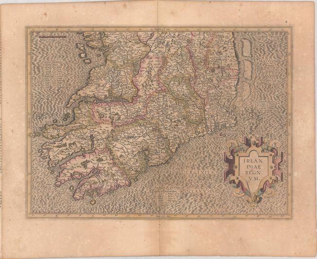
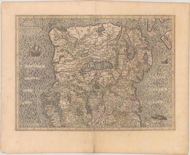
Subject: Ireland
Period: 1619 (circa)
Publication: Gerardi Mercatoris - Atlas sive Cosmographicae…
Color: Hand Color
Size:
18.6 x 13.5 inches
47.2 x 34.3 cm
Superb early pair of maps covering the whole of Ireland compiled from his landmark map of Britain (1564). These two maps were among five Irish maps Mercator designed for the second part of his Atlas. The maps are richly engraved with a moiré pattern in the seas and strong topographical features in the interior. The northern section is decorated with sailing ships and a sea monster and there is no title cartouche - only Mercator's imprint. The southern sheet features the bold, strapwork title cartouche. Size is for each map. French text on verso, published between 1613-30.
References: Law, pp. 19-20; Van der Krogt (Vol. I) #5901:1.1 & #5902:1.1.
Condition: B+
Full contemporary color on lightly toned sheets with scattered foxing. The northern sheet has a 1/2" crack near the center of the image and a centerfold separation that enters less than 1" into image at bottom, both of which have been archivally repaired.