Subject: Baltic
Period: 1729 (published)
Publication: Introductionis in Universam Geographiam
Color: Hand Color
Size:
13.3 x 10.5 inches
33.8 x 26.7 cm
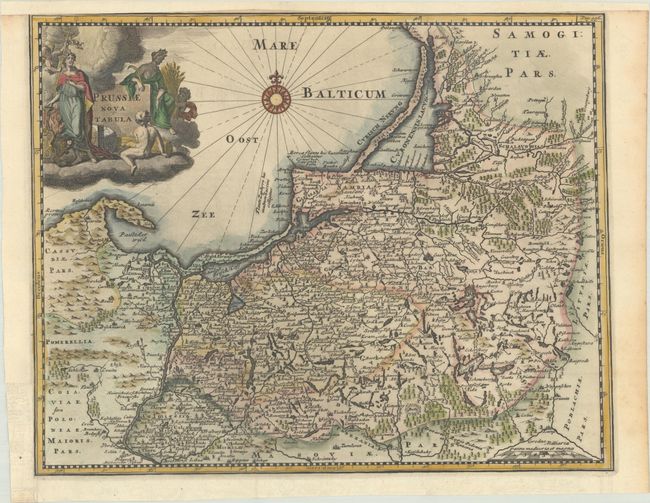
This finely engraved map covers northeastern Poland from about Gdansk to Lithuania, and includes the present-day Russian enclave of Kaliningrad Oblast. The map is filled with detail and engraved with forests, mountains, and fortresses. A large allegorical title cartouche and a compass rose complete the composition.
Cluver's Introductio in Universam Geographicam was a popular atlas, appearing in over 45 editions during a 100-year period. The first edition was published without maps in the 1620s, and the first edition to include maps was published circa 1641. The various editions were published in different cities throughout Europe, including Amsterdam, Nuremberg, and London. This map is from an Amsterdam edition, edited by Bruzen de la Martiniere with maps by Jan Wolters and four newly engraved maps after Delisle.
References: Shirley (BL Atlases) T.CLUV-8b.
Condition: A
A dark impression on a bright sheet with the Amsterdam arms watermark, issued folding with a binding trim at left that has been replaced with old paper. Remargined at top to accommodate framing.