Subject: Western Netherlands
Period: 1671 (circa)
Publication:
Color: Hand Color
Size:
22 x 18.1 inches
55.9 x 46 cm
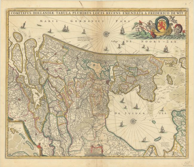
This decorative map depicts Utrecht and parts of Friesland and Brabant with their coasts. The details include canals, roads, polders, marshes, and villages with major cities depicted as miniature bird's-eye plans. The West Frisian Islands are shown in an inset. Compass roses orient north to the right and a variety of sailing vessels fill the seas. A host of mermen pull a sea chariot with the Dutch coat of arms and a pair of surveyors decorate the scale cartouche at bottom. This is De Wit's version of Visscher's very similar map. This is the third state of De Wit's map with a town plan added inside the Amsterdam city walls, published between 1671-76.
References: Carhart (De Wit) #126.3.
Condition: B+
A nice impression with full contemporary color on a bright sheet with light toning along the centerfold, manuscript ink stains at top, and an archivally repaired centerfold separation at bottom.