Subject: Western Belgium
Period: 1680 (circa)
Publication:
Color: Hand Color
Size:
22.6 x 19.2 inches
57.4 x 48.8 cm
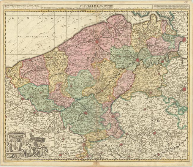
This map of the historical region of Flanders traces the coastline from Grevelingen to Zeeland at de Hont oste Westerschelde, south to below Douay, and east to Brussels. Beautifully engraved and highly detailed, the map shows political divisions, forests, roads, canals, hundreds of tiny villages, and several fortified towns including Brussels and Antwerp. A purely decorative cartouche appears at bottom left, featuring a Belgian lion coat-of-arms, a soldier, a river god, and a cornucopia. Engraved by Gilliam Gouwen.
References:
Condition: A
A crisp impression with full contemporary color on a bright sheet with minor toning along the centerfold. There is a dampstain and accompanying centerfold separation in the bottom margin that has been archivally repaired on verso.