Catalog Archive
Auction 198, Lot 402

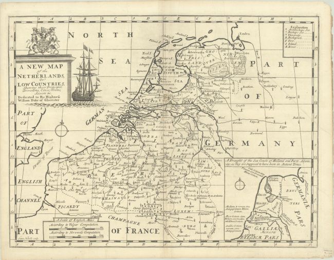
"A New Map of the Netherlands, or Low Countries, Shewing Their Principal Divisions, Cities, Towns, Rivers &c...", Wells, Edward

Subject: Low Countries

Period: 1701 (circa)

Publication: A New Sett of Maps both of Antient and Present Geography

Color: Black & White

Size:
19.1 x 14.4 inches
48.5 x 36.6 cm
Download High Resolution Image
(or just click on image to launch the Zoom viewer)

Fine map of the region with good detail throughout and a small legend identifying symbols. At bottom right is an interesting inset of the coast of Holland in ancient times. The map is handsomely decorated with a plinth-style title cartouche featuring a large sailing ship and the coat of arms of the Duke of Gloucester, to whom the map is dedicated. Engraved by Sutton Nicholls.

References: Shirley (BL Atlases) T.WELL-1a #9.

Condition: B+

A dark impression on a bright sheet with very light toning along the centerfold, minor offsetting, two tiny worm holes in the top border, and several printer's creases. There are tiny tears and some soiling along the edges of the sheet.

Estimate: $150 - $180

Unsold

Closed on 6/19/2024

Archived