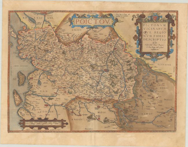
Subject: Western France
Period: 1579 (dated)
Publication: Theatrum Orbis Terrarum
Color: Hand Color
Size:
19.8 x 14 inches
50.3 x 35.6 cm
Beautifully decorated map of the Poitou region of western France between Nantes and Limoges based on a lost original map by Pierre Rogier. Large cities are depicted pictorially, including Nantes, Limoges, La Rochelle, Poitiers, and Saintes. The map is embellished with three strapwork cartouches. Latin text on verso, published in 1579.
References: Van den Broecke #38.
Condition: B+
A dark impression with full contemporary color on a sheet with an eagle watermark, light toning, a tiny hole along the centerfold at top, and marginal soiling. The green pigment has browned, but the paper is still supple.