Subject: Western France
Period: 1579 (dated)
Publication: Theatrum Orbis Terrarum
Color: Hand Color
Size:
18.7 x 14 inches
47.5 x 35.6 cm
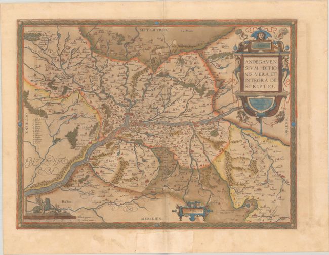
This is an attractive regional map of France focused on the Anjou region of western France, the present day department of Maine-et-Loire. Angers is at map center and is located next to the Maine and Loire rivers. There are numerous bridges displayed and there is a key at left identifying various islands in the Loire River. Ortelius based the map on a now lost map by Lezin Guyet that was published in Paris, 1573. It is richly embellished with bold cartouches and a harpy atop the distance scale. Latin text on verso, published in 1579.
References: Van den Broecke #40.
Condition: B+
A dark impression with full contemporary color on a sheet with an eagle watermark, light toning, a bit of color offsetting, and a few tiny holes along the centerfold. There is marginal soiling and an old paper repair in the bottom margin on recto. The green pigment has browned, but the paper is still supple.