Subject: Western France
Period: 1725 (circa)
Publication:
Color: Hand Color
Size:
23.4 x 18.9 inches
59.4 x 48 cm
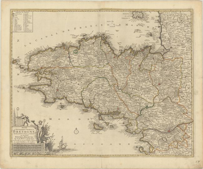
This splendid map of Brittany is filled with information including the fortified cities of Nantes, Rennes, Brest, and Quimper. The roads are clearly marked, as are the forests, swamps, marshes, and rivers. A legend at top left identifies symbols used on the map. The decorative title cartouche features Neptune, Mercury, a mermaid and the arms of the region. This is the third state with the addition of Covens & Mortier's imprint below the title.
References: Carhart (De Wit) #33.3
Condition: B+
A dark impression with full contemporary color on a sturdy sheet with a "C&I Honig" watermark. There is light printer's ink residue, minor soiling, a bit of toning along the centerfold at top, and an archivally repaired centerfold separation at bottom.