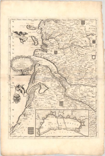
Subject: Southwestern France, Bordeaux
Period: 1696 (circa)
Publication: Isolario Descrittione Geografico-Historica...
Color: Black & White
Size:
17.9 x 24.1 inches
45.5 x 61.2 cm
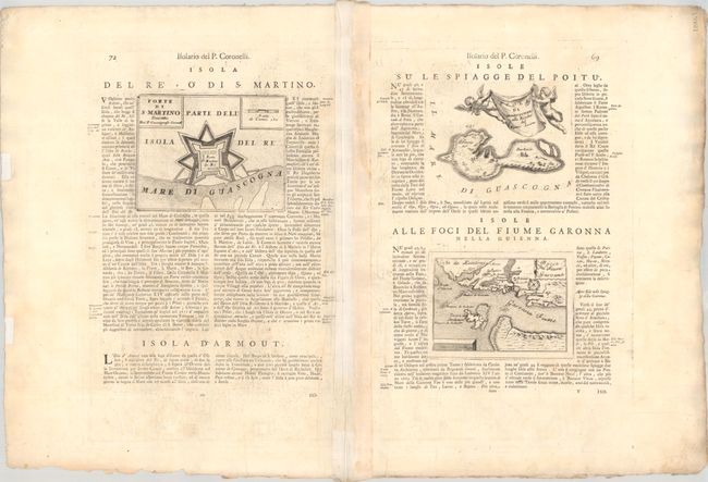
This elegantly detailed map covers Guyenne and the Bordeaux wine region of France. It centers roughly on the Gironde estuary and extends to show the Ile de Re and Ile d'Oleron. Numerous towns and cities are identified, including Bordeaux, Cognac, Rochefort, and Marmande. An inset at bottom details the fortifications of Bordeaux. The map is further decorated by several coats of arms scattered across the landscape, putti, and an elaborate title cartouche. On verso, three additional maps are embedded into the Italian text: Forte di S. Martino (6.6 x 5.1"); Isola di Narmoustier (6.4 x 5.1"); and Bocca del Fiume Garonna (5.9 x 4.1").
References: Shirley (BL Atlases) T.CORO-13a #167-170.
Condition: B+
A crisp impression on a bright sheet with a bit of printer's ink residue, faint toning along the centerfold, and light soiling and dampstaining along the edges of the sheet. There are a few short tears and chips along the edges of the sheet, well away from the image.