Catalog Archive
Auction 198, Lot 447

"Chorographical Map of the Kingdom of Portugal Divided Into Its Grand Provinces", Faden, William
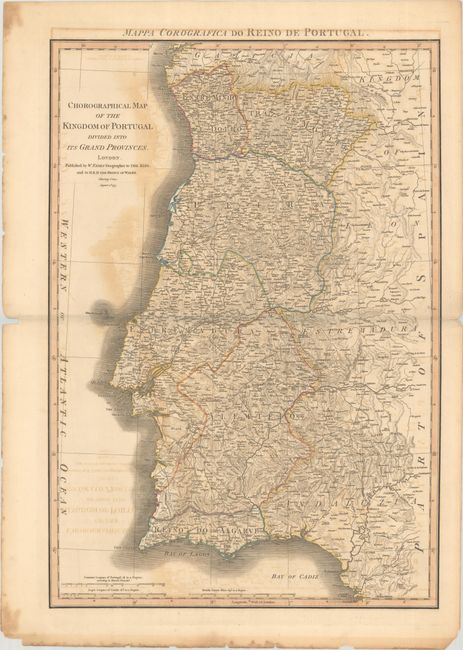
Subject: Portugal

Period: 1797 (dated)

Publication: General Atlas

Color: Hand Color

Size:
19.9 x 29 inches
50.5 x 73.7 cm
Download High Resolution Image
(or just click on image to launch the Zoom viewer)

A beautiful map of Portugal with roads, provinces, settlements and towns. The map is filled with detail and mountains are engraved in hachure. Published by William Faden, Geographer to the King and H.R.H. the Prince of Wales. An alternate title appears above the map: "Mappa Corografica do Reino de Portugal."

References: Phillips (Atlases) #6010-18.

Condition: B

A dark impression with contemporary outline color and moderate offsetting. The edges of the sheet have some toning, foxing, and small chips. There are a few edge tears and a centerfold separation at right that have been closed on verso with archival tape.

Estimate: $160 - $190

Sold for: $120

Closed on 6/19/2024

Archived