Subject: Northwestern Germany
Period: 1659 (circa)
Publication:
Color: Hand Color
Size:
24.6 x 16.7 inches
62.5 x 42.4 cm
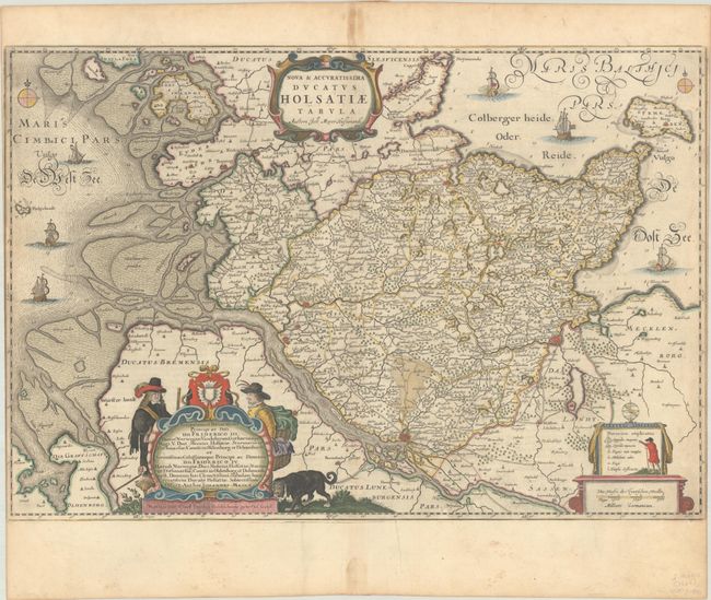
This superb map of northwestern Germany was drawn by Johannes Meyer. It is filled with exceptional detail of the topography, cites, villages, fortifications, roads, bridges, navigation channels, and much more. Large cities, including Hamburg, Lubeck and Itzehoe are depicted as miniature fortified cities. The map is beautifully ornamented with sailing ships, compass roses and three elaborate cartouches. The map is dedicated to King Frederick III and to his son Prince Frederick IV. Spanish text on verso, published between 1659-72.
References: Van der Krogt (Vol. II) #1660:2B.2.
Condition: B+
A sharp impression with full contemporary color on a bright sheet with a large watermark of the god Atlas. The map was trimmed to the neatlines at right and left by the bookbinder. There is minor soiling and toning along the centerfold in the top and bottom margins.