Catalog Archive
Auction 198, Lot 468

"Mappa Geographica Circuli Metalliferi Electoratus Saxoniae cum Omnibus, quae in eo Comprehenduntur Praefecturis et Dynastiis...", Seutter/Lotter

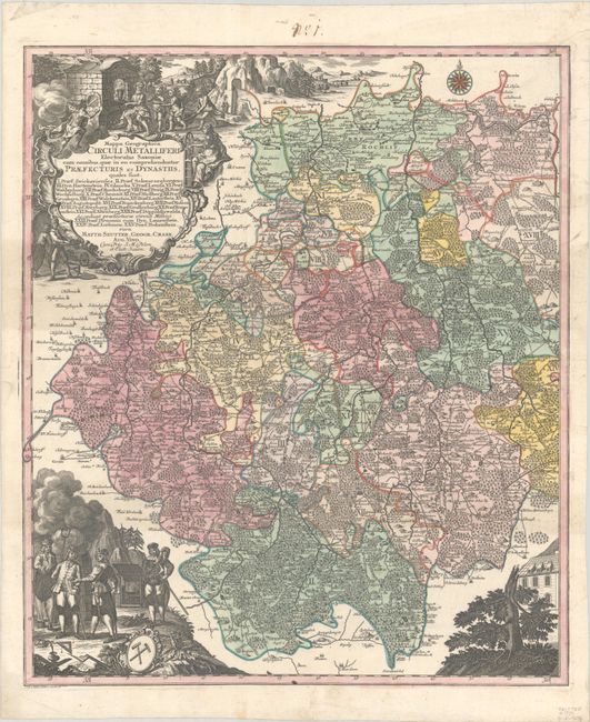
Subject: Southern Germany

Period: 1740 (circa)

Publication:

Color: Hand Color

Size:
19.5 x 22.8 inches
49.5 x 57.9 cm
Download High Resolution Image
(or just click on image to launch the Zoom viewer)

This is the western sheet of a two-sheet map of Saxony that highlights the silver mining operations in the region. The map extends from Greiz (Gratz) in the west to Brand-Erbisdorf in the east, and from Waldheim in the north to Eibenstock in the south. The region is divided into eighteen prefectures and includes great detail of the towns, political boundaries, roads, forests, and rivers. At bottom left is a vignette relating to silver mining. This sheet includes the elaborate title cartouche for the two-sheet map and stands on its own with full borders.

References:

Condition: B+

A sharp impression with full contemporary color on a bright sheet with a faint stain at left and minor soiling. There is an old manuscript ink notation in the top margin.

Estimate: $300 - $375

Sold for: $220

Closed on 6/19/2024

Archived