Subject: Northwestern Poland & Northeastern Germany
Period: 1644 (circa)
Publication: Theatrum Orbis Terrarum
Color: Hand Color
Size:
19.5 x 15 inches
49.5 x 38.1 cm
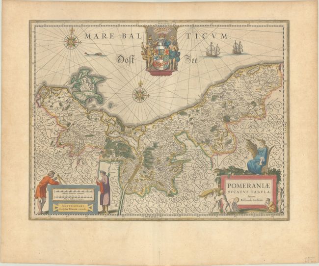
Stunning map of the historic region of Pomerania on the shores of the Baltic Sea, extending west past Straslund and the island of Rugen. This region had been variously annexed by Sweden and Prussia over the years and is today primarily in Poland with a portion controlled by Germany. The map is based on the surveys of Eilhard Lubbin and engraved by S. Rogiers. Two decorative cartouches, an elaborate coat of arms, two compass roses and sailing ships decorate this map. Latin text on verso, published between 1644-55.
References: Van der Krogt (Vol. II) #2190:2.2.
Condition: A
A dark impression with full contemporary color on a watermarked sheet with a bit of printer's ink residue, a printer's crease at top center, and minor toning. There is a short tear in the bottom margin.