Subject: World
Period: 1657 (dated)
Publication: Cartes Generales de Toutes les Parties du Monde…
Color: Hand Color
Size:
21.3 x 15 inches
54.1 x 38.1 cm
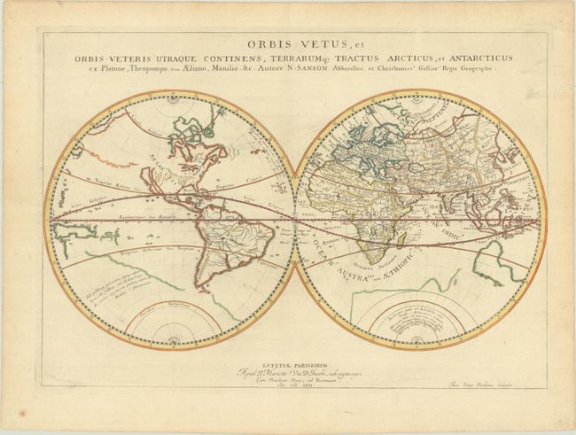
This handsome and very uncommon double-hemisphere world map depicts the ancient world, with classical place names in the eastern hemisphere, and just a few mythical place names in the western hemisphere. The Americas are labeled Atlantis Insula Platoni. The island of California appears beneath a vast, blank, and vaguely defined northwestern landmass. The Great Lakes are open-ended, and there are spurious mountains and rivers throughout the western hemisphere. A partially delineated outline of a large Antarctic continent fills the southern hemisphere and features a quote from Marcus Manilius' Astronomica, the earliest known treatise on astrology. Australia, New Zealand, and what appears to be part of New Guinea or the Solomon Islands are also partially delineated and unnamed. This enduring map was published in subsequent editions of Sanson's atlas from 1665 to 1676 and was followed by an updated edition (dated 1679) and a derivative (first published 1694). Engraved by Jean Somer Pruthenus ("the Prussian").
References: Pastoureau, SANSON V A [98]; Shirley #400; Wagner (NW) #367.
Condition: A
Just a hint of toning on a sheet with a large coat of arms watermark and some printer's ink residue. There is a small paper flaw at bottom left.