Subject: Eastern Europe, Poland
Period: 1772-81 (circa)
Publication:
Color: Hand Color
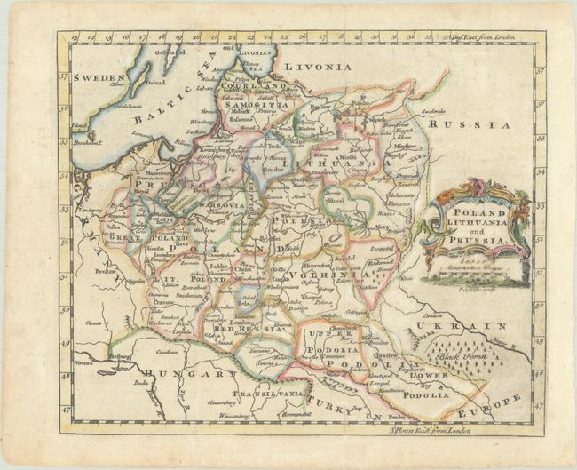
A. Poland Lithuania and Prussia, by Thomas Jefferys, from The New Geographical and Historical Grammar, circa 1772 (8.3 x 6.9"). This interesting map of Eastern Europe shows political divisions, towns, rivers, forests, and mountains. A decorative title cartouche appears in a Russia bereft of detail. Published between 1749-85 in an edition of Salmon's geography. Reference: cf. McCorkle (18th C. Geography Books) #350-9. Condition: Issued folding with light toning and an area of paper weakness below the title cartouche. (B+)
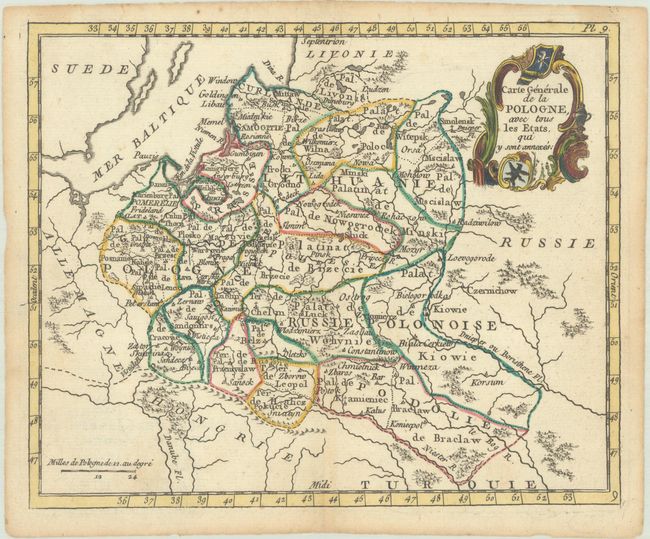
B. Carte Generale de la Pologne, avec tous les Etats, qui y sont Annexes, by Joseph de Laporte, from Atlas Moderne Portatif..., circa 1781 (8.6 x 7.0"). This small, handsome French map of the region extends from the Baltic east to Smolensk, and from the Daugava estuary south to the historic Podolia region and the Dniester River. The ornate title cartouche at top right incorporates Poland's coat of arms. Condition: A crisp impression with light toning along sheet's edges. (A)
References:
Condition:
See description above.