Subject: Russia in Europe
Period: 1680 (circa)
Publication: The English Atlas
Color: Hand Color
Size:
21.2 x 16.5 inches
53.8 x 41.9 cm
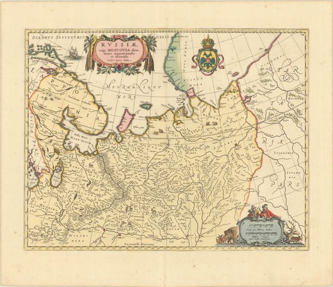
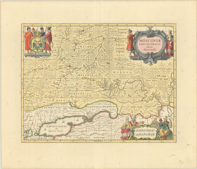
This lot includes a matching pair of maps of Russia, each of which includes a strapwork title cartouche that credits the map to Isaac Massa. Massa visited Moscow in the early 1600s, during the turmoil in Russia following the death of Tsar Boris Godunov and the assassination of the False Dimitry, who only reigned as Tsar for ten months before he was killed in 1606. Blank versos. Published in Moses Pitt and Johannes Janssonius van Waesbergen's The English Atlas, which was based on Jan Jansson's Atlas Maior.
A. Russiae, Vulgo Moscovia Dictae, Partes Septentrionalis et Orientalis. Auctore Isaaco Massa, (21.3 x 16.3"). This map details the area from Finland to Siberia and beyond the Jenisej River and south to the Volga River, with Kazan and Novogorod shown. A partial coastline of Novaya Zemla is shown at the top of the map. The map is fully engraved with mountains and forests with deer and bears. The title cartouche is flanked with pelts, and hunters and a wide variety of animals surround the scale of miles. The crest of the Russian Empire is shown at top. The map is nearly identical to Blaeu's map of the same title.
B. Moscoviae Pars Australis. Auctore Isaaco Massa, (19.4 x 15.1"). This is a very decorative map of the region north of the Sea of Azov including Moscow. The land is fully engraved with forests and wild animals, and tiny ships sail in the sea. There is a title cartouche surrounded by figures in local dress. This is the third state with updated cartouches at top left and bottom right featuring additional regional figures.
References: Van der Krogt (Vol. I) #1801:1.2 & #1802:1.3.
Condition: A
Sharp impressions with full contemporary color on bright sheets with the "P" watermark of Pieter van der Ley. There is a short, archivally repaired centerfold separation on the northern sheet, and minor marginal foxing and soiling on both sheets.


