Subject: Black Sea
Period: 1740 (circa)
Publication:
Color: Hand Color
Size:
26.8 x 22.1 inches
68.1 x 56.1 cm
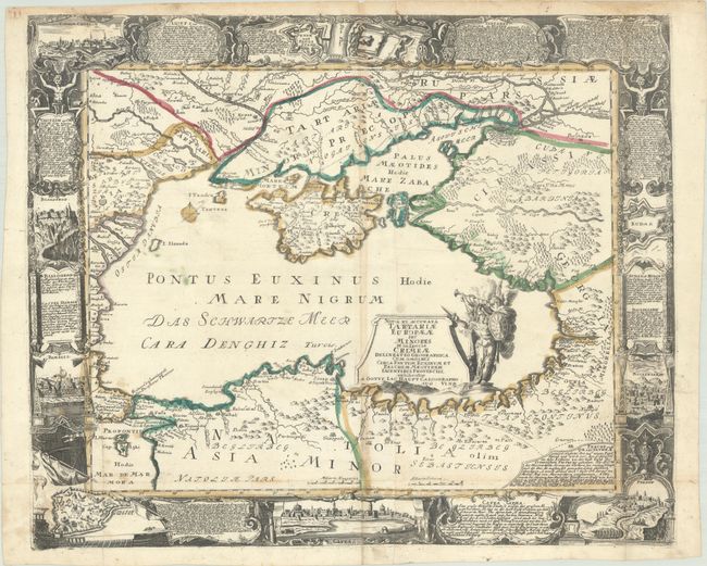
This very rare map of the Black Sea is surrounded by a superb baroque border featuring views of important cities and fortifications within the region. The views include Constantinople, Azov, Kodak Fortress along the Dnieper River, and the cities of Perekop, Bakhchysarai and Kaffa (Feodosia) within Crimea. Between the views are additional cartouches containing descriptions of each of the cities, as well as a brief history on Tartary. The map gives good detail of the region surrounding the Black Sea, including cities, rivers, mountains, and political boundaries. The title cartouche features Athena, the goddess of war, symbolizing the frequent conflicts in the region. This map was created by Gottfried Jacob Haupt, an engraver and publisher from Augsburg. Printed on two joined sheets, as issued.
References:
Condition: B+
A nice impression with full contemporary color, issued folding on a bright sheet. There is light soiling, light toning along the centerfold, and archival repairs to small holes at the fold intersections and to two chips in the top margin. There is an old manuscript ink notation adjacent to Crimea.