Subject: Southern Greece
Period: 1729 (published)
Publication: Introductionis in Universam Geographiam
Color: Hand Color
Size:
10.3 x 8.3 inches
26.2 x 21.1 cm
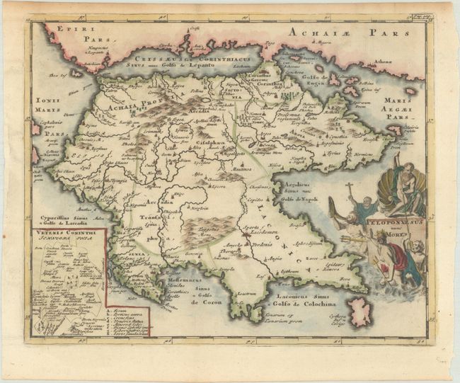
Charming map of the Peloponnesian peninsula, the heart of ancient Greece, with the cities of Sparta, Corinth, Argos and Olympia. An inset plan of Corinth balances the title cartouche featuring Neptune and his entourage.
Cluver's Introductio in Universam Geographicam was a popular atlas, appearing in over 45 editions during a 100-year period. The first edition was published without maps in the 1620s, and the first edition to include maps was published circa 1641. The various editions were published in different cities throughout Europe, including Amsterdam, Nuremberg, and London. This map is from an Amsterdam edition, edited by Bruzen de la Martiniere with maps by Jan Wolters and four newly engraved maps after Delisle.
References: Shirley (BL Atlases) T.CLUV-8b; Zacharakis #629.
Condition: A
A dark impression on a bright sheet with an "RK" watermark and light toning in the top margin.