Subject: Italy
Period: 1729 (published)
Publication: Introductionis in Universam Geographiam
Color: Hand Color
Size:
12.1 x 10.3 inches
30.7 x 26.2 cm
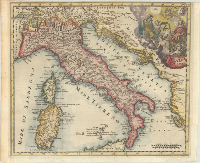
This finely engraved and very detailed map covers the entire country and includes Sardinia and Corsica, part of Sicily, the Adriatic Sea and the western Dalmatian coast. Decorated with a superb, allegorical title cartouche.
Cluver's Introductio in Universam Geographicam was a popular atlas, appearing in over 45 editions during a 100-year period. The first edition was published without maps in the 1620s, and the first edition to include maps was published circa 1641. The various editions were published in different cities throughout Europe, including Amsterdam, Nuremberg, and London. This map is from an Amsterdam edition, edited by Bruzen de la Martiniere with maps by Jan Wolters and four newly engraved maps after Delisle.
References: Shirley (BL Atlases) T.CLUV-8b.
Condition: B+
A dark impression on a bright sheet with the Amsterdam arms watermark, issued folding with a narrow top margin. A binding trim at right has been replaced with old paper, and an adjacent binding tear that just enters the map border has been archivally repaired.