Subject: Northeastern Italy
Period: 1880 (circa)
Publication:
Color: Hand Color
Size:
12.9 x 20 inches
32.8 x 50.8 cm
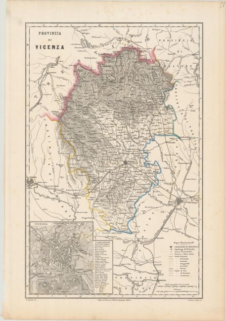
This detailed map of Vicenza and vicinity was published in one of Dr. Francesco Vallardi's Italian atlases. It spans from Verona east to Padua and from Borgo Valsugano south to Rovigo. A key identifies capitals, various roads, railroads, and administrative boundaries. At bottom left is an inset plan of Vicenza, with a list of 29 key destinations. Designed by F. Naymiller and engraved by P. Allodi e Figlio.
References: cf. Rumsey #14396.038.
Condition: A
A crisp impression on a bright sheet with faint foxing that is mostly confined to the blank margins.