Subject: Western Mediterranean & Northern Africa
Period: 1700 (dated)
Publication:
Color: Hand Color
Size:
25 x 19 inches
63.5 x 48.3 cm
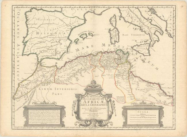
This boldly engraved map focuses on the regions controlled by the Moors in northern Africa and the Iberian Peninsula in the latter part of the medieval period. The map displays good detail along the north African coast from Morocco to Libya. It also covers the western Mediterranean with the islands of Sardinia, Corsica, Malta and the Balearics. Sicily features a smoking Mount Aetna. Three decorative cartouches complete the composition. Engraved by Jean Baptiste Liebaux.
References: Norwich #297.
Condition: A
Contemporary outline color on a bright sheet with a large watermark of a Maltese cross encircled in rosary beads. There is minor offsetting and light toning and foxing along the edges of the sheet.