Subject: Middle East
Period: 1952 (circa)
Publication:
Color: Printed Color
Size:
29.9 x 20.6 inches
75.9 x 52.3 cm
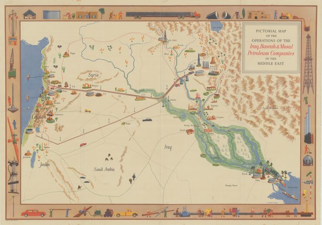
This rare pictorial map was designed by Victor Coverley-Price for the Iraq Petroleum Company (IPC). It spans from the Lebanese coast to the mouth of the Shatt-al-Arab. The IPC Mediterranean pipeline that extends from Haifa to Kirkuk is emphasized, as is the then-new Kirkuk-Baniyas pipeline, which went into operation in April 1952. The decorative border further underlines the theme of oil, with imagery of pipeline construction, derricks, drilling rigs, spherical storage tanks, and more. Several cities are located with accompanying illustrations of ancient monuments, including Jerusalem, Damascus, Aleppo, Palmyra, Mosul, Baghdad, Babylon, and Basrah. The Tigris and Euphrates are prominent and surrounded by lush greenery, with oil tankers shown exiting the river system into the Persian Gulf. The map appeared in an IPC commemorative portfolio with two other pictorial maps and a report titled Iraq Oil in 1951. Coverley-Price (1901-1988) served in the Diplomatic Service from 1925 to 1946 and was a writer, painter, commercial artist, and mountaineer.
References:
Condition: B+
Issued folding with light spots, minor wear along the folds, and a few short fold separations and tiny tears along the edges of the sheet.


