Catalog Archive
Auction 198, Lot 577

"Helespont ou Detroit des Dardanelles pour Servir de Renseignement a la Carte des Limites des Trois Empires ou Theatre de la Guerre Presente", Maire, Francois Joseph

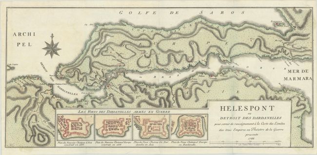
Subject: Dardanelles, Turkey

Period: 1788 (dated)

Publication:

Color: Hand Color

Size:
24.8 x 11.3 inches
63 x 28.7 cm
Download High Resolution Image
(or just click on image to launch the Zoom viewer)

This map depicts the strait of the Dardanelles between the Aegean Sea and the Marmara Sea. Key cities are identified, and topographical detail is shown inland. At bottom are four bird's-eye plans of important forts protecting the Dardanelles, including the new castles of Europe and Asia located at the entrance to the Aegean, and the old castles of Europe and Asia, located within the Dardanelles. A rare map, published by Francios Joseph Maire, an Austrian geographer and publisher.

References:

Condition: A

Full contemporary color, issue folding on a clean and bright sheet with a previous owner's stamp (D. Hans-Peter Kosac) just below the distance scale.

Estimate: $400 - $475

Unsold

Closed on 6/19/2024

Archived