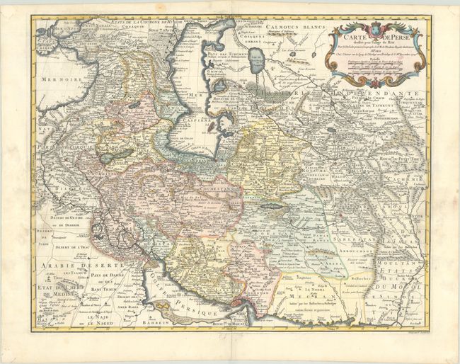
Subject: Persia - Iran
Period: 1724 (dated)
Publication:
Color: Hand Color
Size:
24.3 x 19.3 inches
61.7 x 49 cm
This handsome map of the region is one of the more important maps in the evolution of cartography in the Persian Gulf in the eighteenth century. The map stretches from the Caucasus through Afghanistan and from the Arabian Desert to the Indus River, and shows a new, still developing shape. The map is filled with impressive detail including roads, bridges, forts, cities, villages, watering places and much else of interest. Finely engraved by P. Starckman with his imprint at lower right.
References: Couto, Bacque-Grammont & Taleghani #72.
Condition: B+
A crisp impression on a bright sheet with light dampstains along the sides of the sheet, entering about 1.5 inches into the image at right and left.