Subject: Western Hemisphere - America
Period: 1792 (published)
Publication:
Color: Black & White
Size:
5.4 x 8.7 inches
13.7 x 22.1 cm
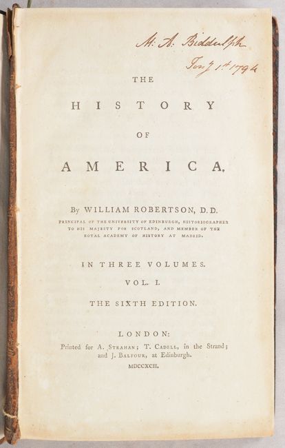
This is the complete sixth edition of William Robertson's History of America, with editions covering a span of at least 35 years (1777 to at least 1812). Howes describes Robertson's work as "the most highly regarded secondary source of its time." This three-volume set is complete with the following four issued maps:
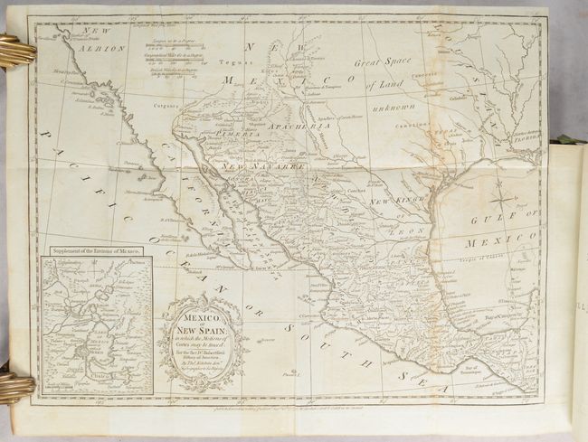
Mexico, or New Spain; in Which the Motions of Cortes May Be Traced... (15.3 x 11.2"). This is a very attractive map of the American Southwest and Mexico. California is labeled New Albion with no detail outside of a few coastal place names. The region of present-day Arizona and New Mexico is well delineated with numerous Indian villages and the locations of missions. The area from New Mexico to Louisiana is named as "Great Space of Land Unknown." The small Texas settlement of Cenis is near the New Kingdm. of Leon. An inset shows Mexico City on the large Lake of Mexico. Finely engraved with a decorative title cartouche and compass rose. Published by W. Strahan and T. Cadell. Condition: Light offsetting. (B+)
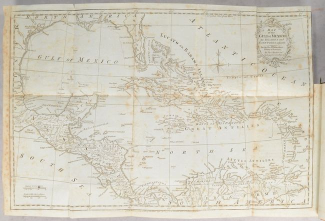
Map of the Gulf of Mexico, the Islands and Countries Adjacent (19.3 x 12.3"). Lovely copper-engraved map covering the region from Florida and the Gulf coast to northern South America. The southern portion of Florida is fragmented into numerous waterways. There is crisp detail of the many islands, the South American coast and Central America. Condition: Scattered foxing. (B)
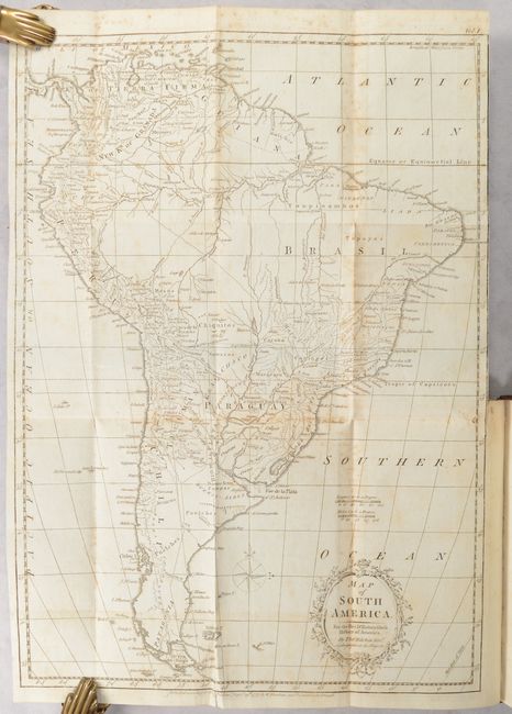
Map of South America (17.7 x 12.6"). Nice map of the continent with good detail of towns, villages, ports and topography. Delicately engraved title cartouche indicates Kitchin is the Hydrographer to his Majesty. Condition: Scattered foxing. (B)
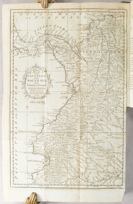
Map of the Countries on the South Sea, from Panama to Guayquil (9.3 x 14.5"). Strongly engraved map of northwestern South America that includes portions of Colombia, Ecuador, and Panama. Extends south to below Cape Blanco and Colan. Filled with details and place names, watersheds and topographical information. Rococo-style title cartouche with distance scale below. Condition: Light foxing. (B+)
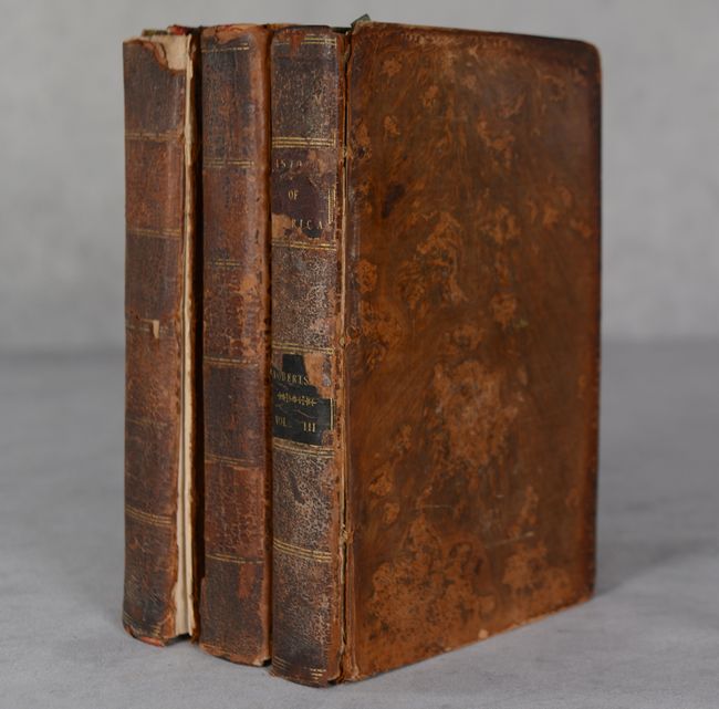
1,326 total pages plus index (vol. 1 - 388 pp., vol. 2 - 499 pp., vol 3 - 439 pp.). Hardbound in full contemporary leather.
References: Howes #R-358.
Condition: B
See description for condition grades of folding maps. Text is very clean and tight. Two former owner bookplates are present on the front pastedowns. Front covers are detached from volumes 1 and 2, while the front board to volume 3 is starting. Bindings are moderately worn with bumped corners and missing title labels from the spines on the first two volumes.