Subject: Southeast Asia & Madagascar
Period: 1534 (circa)
Publication: Isolario
Color: Black & White
Size:
5.8 x 3.4 inches
14.7 x 8.6 cm
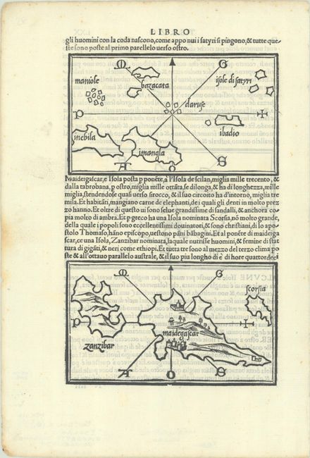
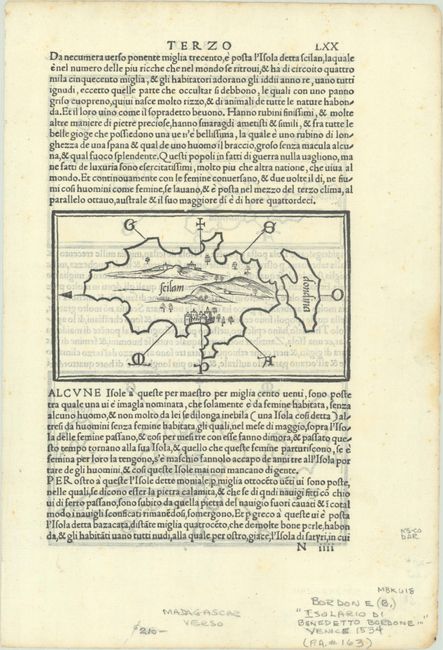
This sheet from Bordone's Isolario features three simple and elegant woodblock maps. The top map depicts a series of spurious islands in Southeast Asia, many of them invented by Ptolemy. Two appear here for the first time on a printed map: Imangla, allegedly an island of women, and Inebila, a corresponding island of men. The population of Bazacata were said to be nudists. Below this is a map of Madagascar with a large Zanzibar to its immediate west. On verso is a map showing Scilam and Dondina, a pair of islands Bordone locates to the immediate southeast of the Malay Peninsula. On a sheet of Italian text measuring 8.4 x 12.4".
Bordone was an illuminator and wood-engraver working in Venice, when he was given permission by the Senate in 1508 to print maps of Italy and the world. None of those maps have survived and his only remaining works are the maps from his Isolario. Isolario, which translates as "book of islands," was the first atlas covering the entire world based on contemporary information rather than classical geography. It included 112 simple and striking maps scattered through the text, depicting islands throughout the world, with a particular emphasis on islands in the Mediterranean Sea. Bordone first published his Isolario in 1528, with further editions in 1534, 1547, and 1565.
References: Mickwitz & Miekkavaara #28-111 & 112; cf. Shirley (BL Atlases) T-BORD-1a #110 & 111; Suarez (SEA) p. 120-21.
Condition: A
A sharp impression on a bright sheet with a small stain along the left sheet edge.