Subject: Africa
Period: 1700 (dated)
Publication:
Color: Hand Color
Size:
23 x 17.8 inches
58.4 x 45.2 cm
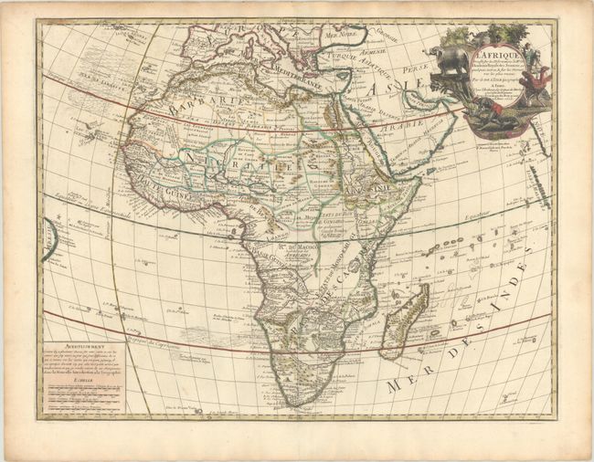
This is Delisle's landmark map of Africa, and is distinguished by his scientific approach to cartography. Most of the maps of Africa issued in the eighteenth century were based on this map. Delisle's map shows the source of the Nile River correctly for the first time with its origins in Abyssinia, rather than the two Ptolemaic-based lakes. The Congo or River Zaire, R. du Saint Esprit and the Zambezi appear in the south, along with the Dutch settlement of Hellenbok at the Cape. Several native kingdoms are named, as well as the site of various mining districts. The title cartouche is beautifully decorated with elephants, an ostrich, natives and a crocodile. This is the fourth state with Renard's imprint below the title cartouche, published between 1708-18.
References: Betz #174.4; Norwich #59.
Condition: A
A dark impression with contemporary outline color in the map and later color in the cartouche, on a bright sheet with a Society of Jesus watermark. There is light toning along the top edge of the sheet and a short centerfold separation confined to the bottom margin.