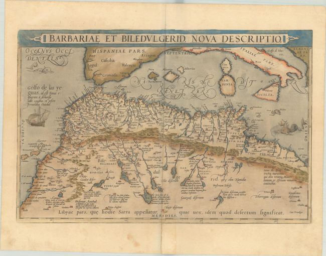
Subject: Northern Africa
Period: 1579 (published)
Publication: Theatrum Orbis Terrarum
Color: Hand Color
Size:
19.8 x 13 inches
50.3 x 33 cm
Handsome map of the famed Barbary coast based on Gastaldi's Africa. The map extends from Morocco to Libya and the western Mediterranean showing the proximity of the Balearic Islands, Corsica, Sardinia, southern Italy and Sicily. Richly engraved with place names, mountains, and numerous spurious lakes in the Sahara Desert. The title is contained in a strapwork panel across the top. Two fantastic sea monsters and a sailing ship ornament the map. This is the first state, with Latin text on verso.
References: Van den Broecke #176.
Condition: B+
A dark impression with full contemporary color on a sheet with the crossed arrows watermark commonly found on Ortelius maps. There is minor toning, marginal soiling, and archival repairs to a centerfold separation that enters the border at bottom and a tear that enters 1.5" into the image at bottom. The green pigment has begun to brown, but the paper is still supple.