Subject: Southern Africa
Period: 1781-83 (circa)
Publication:
Color: Hand Color
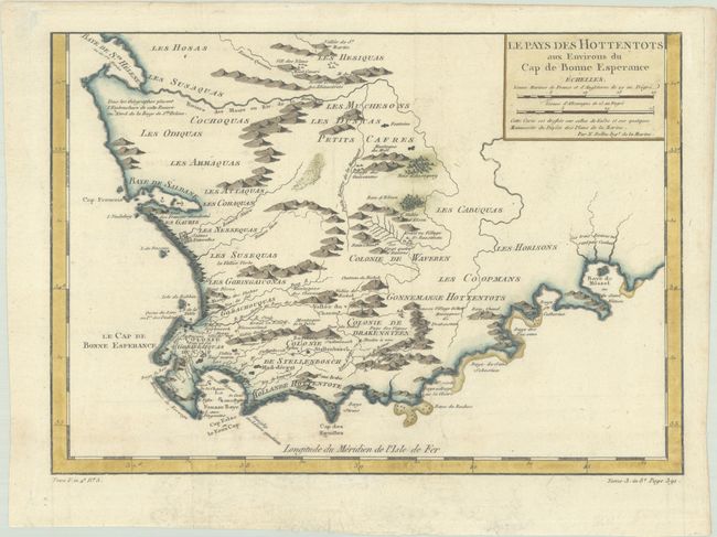
A. Le Pays des Hottentots aux Environs du Cap de Bonne Esperance, by Jacques Nicolas Bellin, from La Harpe's Histoire Generale des Voyages..., circa 1781 (13.7 x 9.6"). A beautifully engraved copper-plate map of the Cape of Good Hope from Saint Helena Bay to Mossel Bay. Dutch settlements are mostly confined along the coast and southern regions. The inland regions are depicted as deserts, savannas, forests, and mountain ranges, with tribal names and a few Boer colonies located. Condition: Issued folding now flat on watermarked paper dated 1781. There is some minor foxing at bottom.
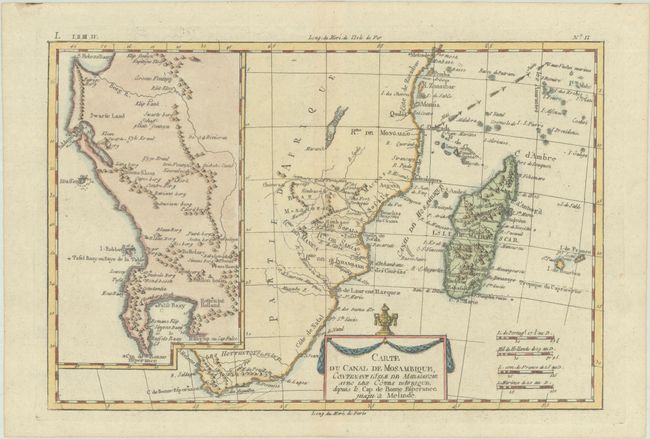
B. Carte du Canal de Mosambique, Contenant l'Isle de Madagascar avec les Cotes d'Afrique, Depuis le Cap de Bonne Esperance, Jusqu'a Melinde, by Rigobert Bonne, circa 1783 (12.5 x 8.3"). This copper engraved chart delineates the southern and southeastern portions of Africa from the Cape of Good Hope to Zanzibar, including Madagascar. There is minimal inland detail except for the names of several tribes. At left is a large, detailed inset map of the region between the Cape of Good Hope and St. Helena Bay. The trade winds are graphically depicted in the Indian Ocean. Condition: A nice impression on a clean sheet. There is a hinge tape remnant on verso.
References:
Condition: A
See description above.