Subject: Colonial North America
Period: 1780 (circa)
Publication: Atlas de Toutes les Parties Connues du Globe Terrestre
Color: Hand Color
Size:
12.8 x 8.5 inches
32.5 x 21.6 cm
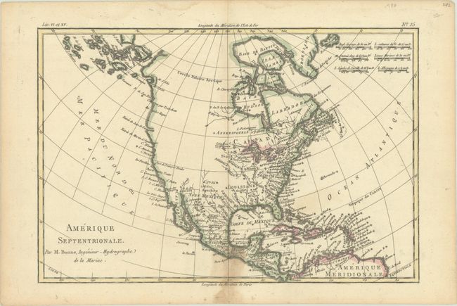
The entire western part of the continent is left mostly blank on this map of North America. Indian tribes occupy the edges of defined territory, including Apaches, Sioux, Outagamis, and Assenipouels. The British Colonies and a few major cities are named along the eastern seaboard and in the Great Lakes region. Alaska is shown as a group of islands, the largest of which is labeled Alaschka. Place names fill Mexico and the Caribbean.
References: Sellers & Van Ee #170.
Condition: B+
A crisp impression on a bright sheet with dampstains along the edges of the sheet, entering the image at bottom center. There is also a very faint stain east of Florida.