Subject: Tasmania
Period: 1844 (circa)
Publication: National Atlas of Historical, Commercial and Political Geography
Color: Hand Color
Size:
19.8 x 24 inches
50.3 x 61 cm
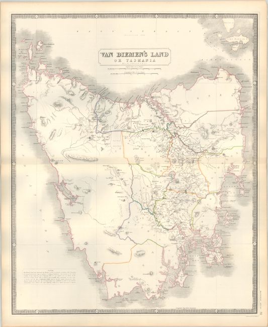
This is one of the largest and most detailed maps of Tasmania from the period, as it was typically depicted as an inset on maps of Australia. It shows political divisions including Kent, Buckingham, Devon, Dorset, Cornwall, Glamorga, Cumberland, Monmouth, and others. A large unsettled region is unnamed in the west, and would eventually be organized into Wellington, Russell, Lincoln, Montagu, Franklin, Montgomery and Arthur. The map locates the towns of Hobart, George Town, Oatlands, Richmond and Bothwell Grantham, as well as scores of small villages and settlements, all connected by a network of wagon roads. The core of settlement is limited to the central portions. The Penal Colony in Port Arthur is not noted. The map's scale of 10 miles per inch provides remarkable detail of the topography, watersheds and coastlines.
References:
Condition: A
Contemporary outline color on a sturdy sheet with a hint of toning along the sheet edges.