Subject: Southern Tasmania
Period: 1787 (circa)
Publication: Atlas Encyclopedique
Color: Hand Color
Size:
13.6 x 9.3 inches
34.5 x 23.6 cm
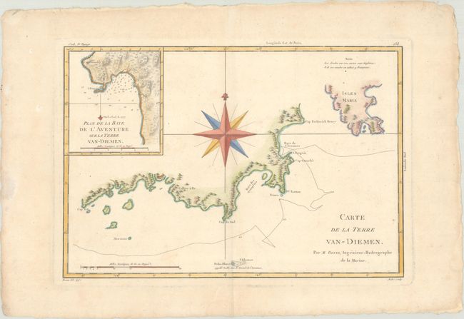
This handsome copper engraved chart covers the southern coast of Tasmania. It extends from Cap S.O. at the far southwestern tip of Tasmania to the southern coast of Bruny Island and across the Frederick Henry Bay to the Tasman Peninsula. In the top left corner, there is an inset zeroing in on Adventure Bay. Adventure Bay was named by Captain Tobias Furneaux in 1773, after spending five days there in his ship HMS Adventure. Tobias commanded the Adventure as part of Captain Cook's second voyage. The bay was also used as an anchorage by William Bligh on the HMS Bounty in 1788 and in 1792 on the HMS Providence. The chart is centered on a large, French-style compass rose. Engraved by Andre.
References:
Condition: A
A crisp impression on a watermarked sheet with deckled edges, minor soiling, and marginal light toning and dampstaining.


