Catalog Archive
Auction 198, Lot 671
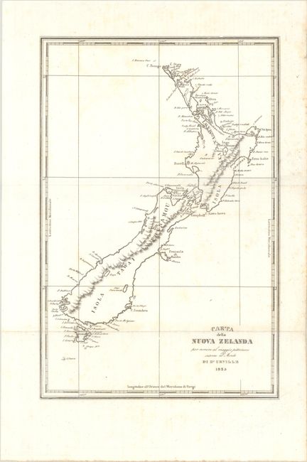
"Carta della Nuova Zelanda per Servire al Viaggio Pittoresco Intorno al Mondo", Dumont d'Urville, Jules Sebasian Cesar

Subject: New Zealand
Period: 1835 (dated)
Publication:
Color: Black & White
Size:
8.7 x 13.1 inches
22.1 x 33.3 cm
Download High Resolution Image
(or just click on image to launch the Zoom viewer)
(or just click on image to launch the Zoom viewer)

