Subject: North America
Period: 1790 (circa)
Publication:
Color: Hand Color
Size:
22.6 x 17.8 inches
57.4 x 45.2 cm
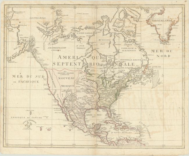
This map of the continent shows the nascent United States with Georgia, the Carolinas, and Virginia extending to the Mississippi River. Beyond the Mississippi is a large Louisiane, Nouveau Mexique, and almost entirely blank Nouvelle Albion, which all extend north close to the present-day border with Canada. Alaska is coming into form, particularly the Aleutian Islands which are named Alaschka, with two erupting volcanoes depicted above Bristol Bay. The map extends as far northwest as the "continent of solid ice" which was discovered by the English in 1778, and the region north of the Arctic Circle is labeled Contree Inconnue. In the Pacific Ocean, a note along the Hawaiian coast indicates Captain Cook was killed there in 1779. The vast interior includes some detail of the river systems, lakes, topography and early settlements, particularly along the upper Rio Grande.
References:
Condition: B
Issued folding on "ATEAS" watermarked paper with contemporary outline color. There is some staining and minor foxing in the image.