Subject: North America
Period: 1830 (circa)
Publication:
Color: Hand Color
Size:
35.1 x 15.3 inches
89.2 x 38.9 cm
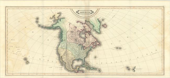
This sizeable map of North America is printed on 2 joined sheets, as issued. It extends west into the Pacific Ocean to include Hawaii and east into the Atlantic to includes the Azores and Cape Verde Islands. In North America, the boundary between the U.S. and Canada ends at the Rocky Mountains, reflecting the shared interests in the Pacific Northwest. The Stony Mountains are shown as a mostly straight spine running north to south. The Great Basin is mostly blank with a speculative river running from Salt Lake to Drake's Bay. Alaska and much of western Canada is Independent Countries.
References:
Condition: B+
A crisp impression with contemporary color. There is some light offsetting at left and right and faint toning along the centerfold. Issued folding.