Subject: Atlases
Period: 1775 (published)
Publication:
Color: Hand Color
Size:
3.4 x 5.1 inches
8.6 x 13 cm
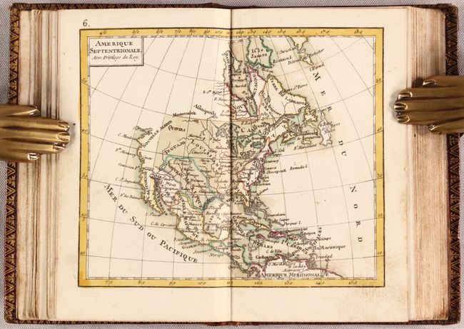
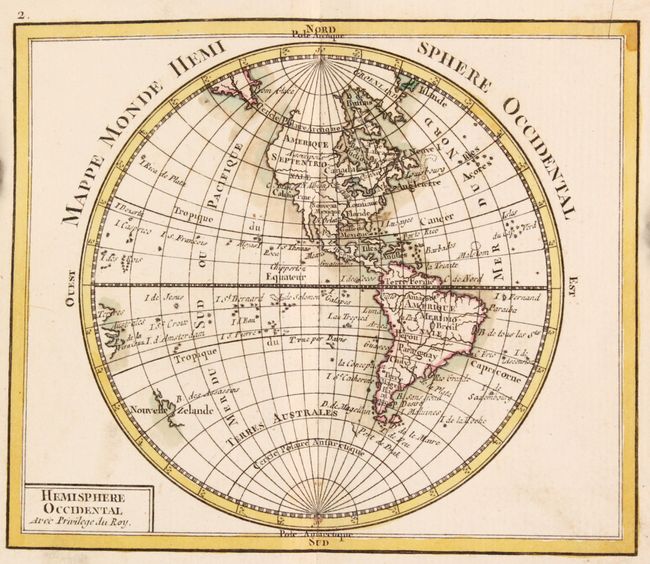
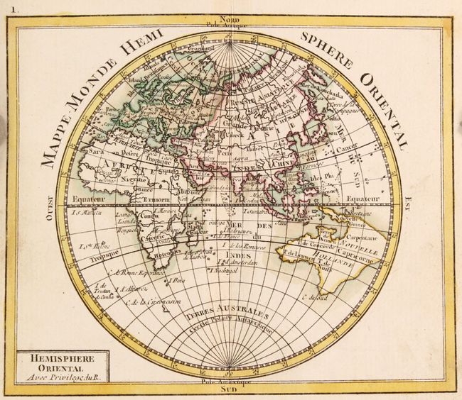
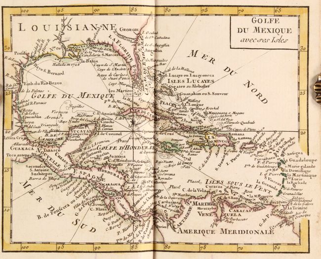
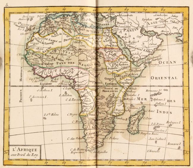
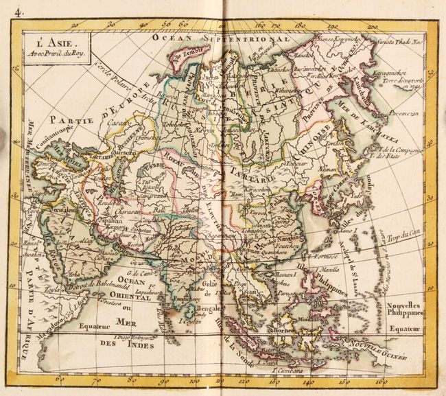
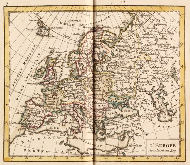
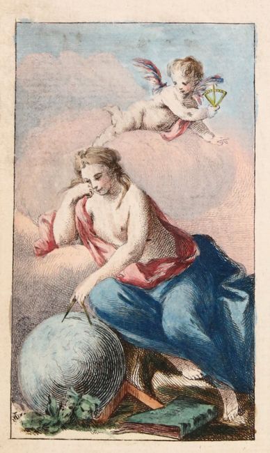
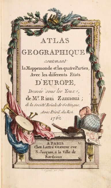
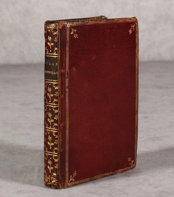
This handsome miniature atlas is complete with 30 maps. It includes maps of the Eastern and Western hemispheres, the continents (Europe, Asia, Africa, and North and South America), and the regions of Europe. Also included in this edition are four new maps that did not appear in the first edition of 1762: Golfe du Mexico avec ses Isle, Russie en Europe, La Pologne, and Turquie d'Europe. A new Ptolemaic diagram has also been added. Cartographically, the map of the Eastern Hemisphere shows a large Australian landmass with New Guinea and Tasmania still connected, and the North America map shows a virtually blank northwestern coast and the British colonies are simply labeled Caroline. There is an attractive frontispiece depicting the allegorical figure of Geography measuring a globe with a putto's assistance. Although the title page is still dated 1762 (the publication date of the first edition), an additional title page (Etrennes Geographiques) opposite the frontispiece puts the publication date for this edition at 1775. Engraved by Lattre. 12mo., hardbound in original maroon leather with gilt decorations and title on spine.
References: cf. Shirley (BL Atlases) T.RIZ-1b.
Condition: A
Maps are in near fine condition with contemporary color and occasional minor soiling, marginal stains, and a short edge tear on one of the maps of France. Covers are lightly scuffed with bumped corners and a few stains on the back cover.