Subject: Eastern Canada, Quebec
Period: 1798 (circa)
Publication: Travels Through the States of North America
Color: Black & White
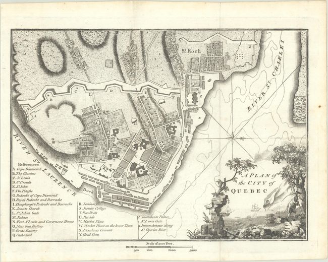
A. A Plan of the City of Quebec, circa 1798 (9.4 x 6.8"). This is an uncommon plan of Quebec that contains a very decorative title cartouche with trees, ships in the harbor and a man planting the French flag. There is excellent detail of street layout with a legend at lower left locating the more important buildings and places of the city. The protective fortifications and walls are well shown. Distance scale in the lower margin is in feet. This map is virtually identical to Andrews' edition but lacks the date in the cartouche and the engraver's attribution, and hatching has been added to the buildings and the waterline is emphasized with additional printing. Condition: Issued folding on a bright sheet with a small faint stain at right. (A)
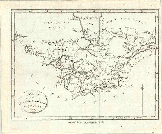
B. A New Map of Upper & Lower Canada, dated 1798 (9.1 x 6.8"). This small map is centered on the Great Lakes and extends from Lake Winnipeg in the west to the mouth of the St. Lawrence and Anticosti Island in the east. There is nice detail of watersheds, shoreline and the southern portion of James Bay. The map locates a number of important forts including Ft. Chambly and Ft. George. Published by John Stockdale on November 10, 1798. Condition: Issued folding with faint offsetting and minor foxing mostly in the blank margins. (B+)
References: Kershaw #992 & #1079; Howes #W-235.
Condition:
See description above.