Subject: Western Canada, British Columbia
Period: 1948 (dated)
Publication:
Color: Printed Color
Size:
26 x 43.5 inches
66 x 110.5 cm
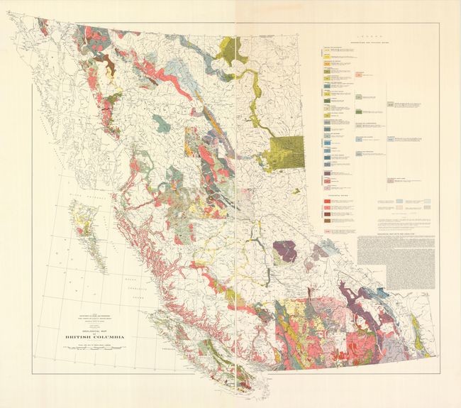
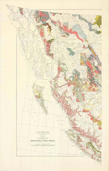
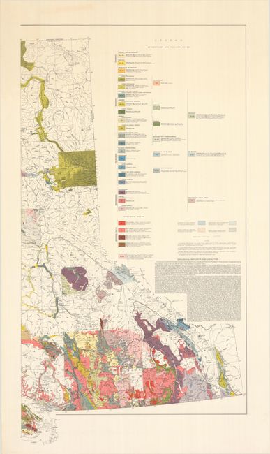
This highly detailed and visually pleasing geological map was published under the direction of the Canadian Department of Mines and Resources. It covers all of British Columbia (and a sliver of Alaska) with a color-coded legend at right identifying 49 geological types of sedimentary, volcanic, and intrusive rocks along with their relative ages. In addition to the geology, the map presents good baseline data including rivers, mountain peaks, offshore islands, roads, railroads, and more. Published as part of the Geological Survey of Canada, which up to this point in time had only mapped a quarter of the country's geology.
References:
Condition: A
The map is clean and colorful on bright sheets. The left sheet has some tiny edge chips and narrow stains along the right sheet edge, far from image. The first image is a composite image - the map is in two separate sheets.