Subject: World
Period: 1709 (circa)
Publication:
Color: Hand Color
Size:
12.9 x 8.2 inches
32.8 x 20.8 cm
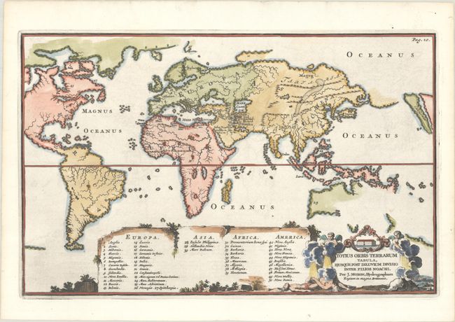
This interesting and unusual world map was designed to illustrate how the world was divided among the sons of Noah. The map is presented on Mercator's projection, with Europe, Africa, and Asia at the center, and South America and a part of North America at left. The island of California is placed at the extreme right of the map, and a Northwest Passage seems entirely probable. This map has practically no detail other than rivers and mountain ranges, except for a tiny engraved depiction of the Garden of Eden located just south of the Caspian Sea. A large table at bottom provides a numeric key to major locations throughout the world. The title cartouche includes a scene of Noah's Ark and the Great Flood. This map was created by Francois Halma, based on Joseph Moxon's map from 1671, and was published in Dutch bibles. Shirley erroneously dates the map 1671 and attributes it to the Moxon family.
References: Poortman & Augusteijn #165; Shirley #458.
Condition: A
A dark impression on a clean, bright sheet with very minor offsetting.