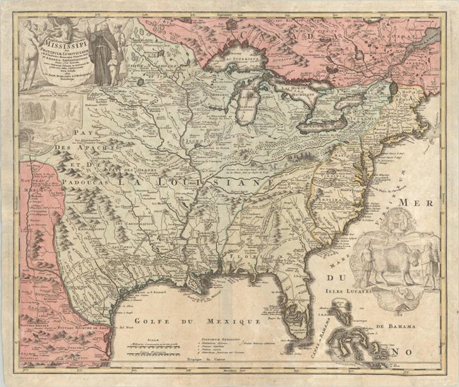
Subject: Colonial Eastern United States & Canada
Period: 1720 (circa)
Publication:
Color: Hand Color
Size:
23 x 19.4 inches
58.4 x 49.3 cm
A striking map based on Delisle's landmark map of 1718, but covering a slightly larger area. It focuses on the Mississippi River Valley interior and Great Lakes, also detailing the Gulf Coast region, where the Mission de los Teyas is noted in present-day Texas. The map is splendidly adorned by vignettes of a bison and Native Americans in a cartouche filling the Atlantic, and a beaver colony at Niagara Falls under the title cartouche at upper left. Also depicted in the title cartouche is Father Louis Hennepin who explored the Great Lakes region and claimed to have reached the mouth of the Mississippi. The routes of Hennepin, de Soto and other explorers are traced in the map.
References: McCorkle #720.1; Goss (NA) #49; cf. Wheat (TMW) #144; cf. Cumming (SE) #170.
Condition: B+
A strong impression in the map and a slightly weaker impression in the decorative elements. The lightly toned sheet has been pressed flat and backed with tissue to repair a number of small chips and tears at lower right, with a 1.25" section of border drawn in facsimile.