Subject: Northwestern United States & Canada, Southeast Alaska
Period: 1798 (published)
Publication: Voyage Autour du Monde, Pendant les Annees 1790, 1791, et 1792...
Color: Black & White
Size:
9.4 x 8.4 inches
23.9 x 21.3 cm
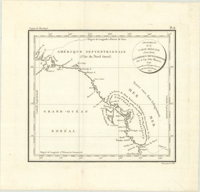
This rare and unusual map depicts Captain John Meares' vision of the Sea of the West. It spans from Mount Olympus and the Strait of Juan de Fuca north to Prince William Sound and Cook Inlet. Meares (ca. 1756-1809) is one of the more colorful figures in the early European exploration of the Northwest coast and Alaska. He claimed many of the discoveries of others as his own and rekindled the idea of the Sea of the West and a Northwest Passage. His mythical inland sea appears stretching from the Strait of Juan de Fuca northwards to just north of the Queen Charlotte Islands. A note indicates that the American sloop Lady Washington captained by Robert Gray had explored this sea in 1789. This was a complete fabrication on the part of Meares; nevertheless it gave new credence to the idea and appears on several later maps as well. Meares played a part in the Nootka Crisis, an international incident that almost pushed Britain and Spain into war against each other. Published in an account of Etienne Marchand's circumnavigation of the globe. Engraved by E. Collin.
References:
Condition: A
Issued folding on a clean sheet of watermarked paper.


