Catalog Archive
Auction 198, Lot 97

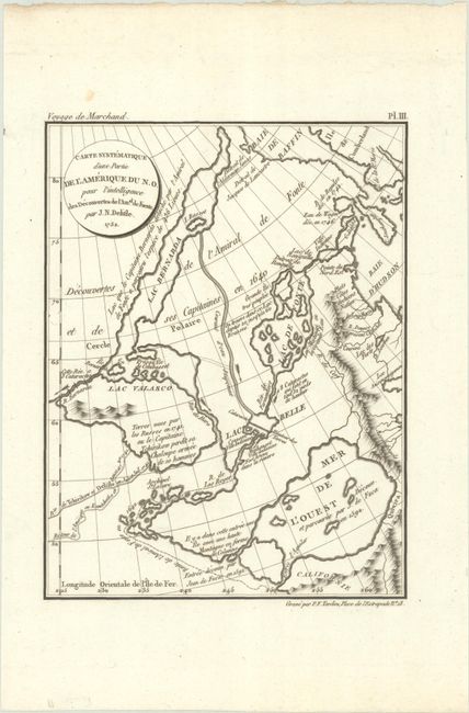
"Carte Systematique d'une Partie de l'Amerique du N.O. pour l'Intelligence des Decouvertes de Amal. de Fuente. par J.N. Delisle. 1752", Delisle, Joseph Nicholas

Subject: Northwestern United States & Canada

Period: 1798 (dated)

Publication: Voyage Autour du Monde, Pendant les Annees 1790, 1791, et 1792...

Color: Black & White

Size:
6.2 x 8.1 inches
15.7 x 20.6 cm
Download High Resolution Image
(or just click on image to launch the Zoom viewer)

The major focus of this map is on infamous expedition by Admiral Bartholomew de Fonte's in the Pacific Northwest. In 1708, a newly discovered account of the Spanish Admiral's 1640 expedition was published. It was actually a hoax, but thereafter the account was changed and elaborated upon by numerous mapmakers. The extravagant claims included the discovery of the Northwest Passage and a huge Sea of the West, all shown on this map. The fictitious waterways include Lac Bernarda, Lac Velasco and Lac de Fonte. Published in an account of Etienne Marchand's circumnavigation of the globe. Taken from an earlier map by Delisle and engraved here by Tardieu.

References: McGuirk #228; cf. Wagner #571.

Condition: A

A dark impression on a clean sheet of watermarked paper.

Estimate: $325 - $400

Sold for: $200

Closed on 6/19/2024

Archived