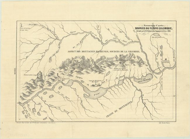
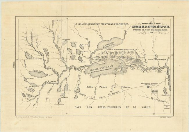
Subject: Northwestern United States & Canada
Period: 1846 (dated)
Publication: Missions de l'Oregon et Voyages aux Montagnes Rocheuses...
Color: Black & White
Size:
8.2 x 5.2 inches
20.8 x 13.2 cm
These two scarce small folding maps were issued in a French edition of De Smet's Oregon Missions and Travels Over the Rocky Mountains, in 1845-46. The first map depicts De Smet's route along the Columbia River up to the source at Columbia Lake, British Columbia, while the second map shows his travels in the Flathead Lake area of Montana. Wheat notes that both are "detailed, well-planned maps, and both contain curious drawings of mountains, with great pyramids and castellated peaks." He continued that his maps "stand with Emory's as the most notable cartographic contributions of 1847." These maps were printed in the Ghent edition of 1848.
De Smet was one of the earliest and most important missionaries active in the American West. Both Wheat and Wagner-Camp illustrate De Smet's maps, reflecting their cartographic importance.
References: Wheat (TMW) #538 & #539; cf. Wagner & Camp #113a:1; Howes #D-288.
Condition: B+
Issued folding with faint offsetting and a few short fold separations that have been closed on verso with archival tape.