Catalog Archive
Auction 198, Lot 99

Locates the State of Franklin in Present-Day Ohio

"Karte von Nord Amerika von 50sten Grade der Breite bis Gegen den Wendekreiss des Krebses, nach den Neuesten Angaben ", Zimmerman, Eberhard A.W.

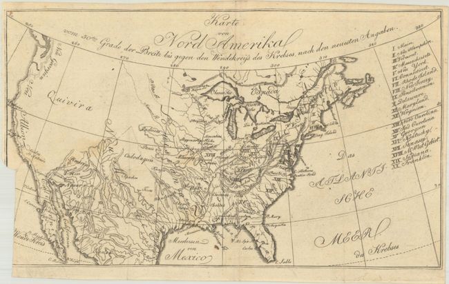
Subject: United States, Franklin

Period: 1805 (circa)

Publication: Taschenbuch der Reisen, oder Unterhaltende Darstellung der Entdeckungen des 18ten Jahrhunderts...

Color: Black & White

Size:
10.7 x 6.4 inches
27.2 x 16.3 cm
Download High Resolution Image
(or just click on image to launch the Zoom viewer)

This is the first state of this small map that was published in Zimmerman's Taschenbuch der Reisen, oder Unterhaltende Darstellung der Entdeckungen des 18ten Jahrhunderts. The volume was the fourth title in Zimmerman's annual compilations, and is devoted entirely to America. The map itself covers the entire present-day United States and lists twenty states in a table at right including the short-lived state of Franklin, which is erroneously identified in present-day Ohio. Topography and drainage is emphasized in this map with only a few place names west of the Missouri River, including a large Quivira in the Great Basin and Neu Albion along the west coast.

References: Dotson & Baker (OWA) #21.1.

Condition: B

Issued folding on watermarked paper with a binding trim at bottom left that excises a 2.5" vertical section of border and an adjacent 0.5" tear that has been closed on verso. There are a few small faint stains and a few tiny holes. Narrow margins, as issued.

Estimate: $275 - $350

Sold for: $140

Closed on 6/19/2024

Archived