Subject: Colonial Eastern United States & Canada
Period: 1778 (published)
Publication: The North American Gazzetteer
Color: Black & White
Size:
14.9 x 10.9 inches
37.8 x 27.7 cm
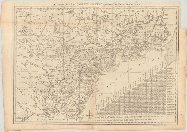
An interesting map showing the British view of their colonies at the outbreak of the American Revolution. Based on the cartography of Thomas Jefferys, the map covers from James Bay to the Gulf of Mexico and provides many details about the frontier wilderness, including numerous early forts, Indian villages and tribal territories. In the south, Earl Granville's Property in North Carolina is shown extending beyond the Mississippi River. In the north, the mythical islands in Lake Superior are a hold-over from earlier French cartographers. The map is augmented by a large triangular table at the lower right that provides distances between major cities and forts.
References: McCorkle #776.15; Sellers & Van Ee #160.
Condition: B+
Issued folding with a couple of light extraneous creases, minor toning and foxing, and a short binder's trim at top right with a related tiny repaired binding tear.