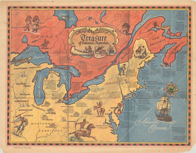
Subject: Northeastern United States & Canada
Period: 1950 (circa)
Publication:
Color: Printed Color
Size:
13 x 10 inches
33 x 25.4 cm
This interesting and unusual treasure map extends from the Atlantic Seaboard west to the Mississippi River, Great Lakes, and James Bay. It contains text describing various hidden treasures where numerous X's mark the spot. A few of the treasures featured on this map include those of Captain Kidd (Oak Island, Deer Isle Cave, and Clarke's Island), Blackbeard, Pirate Quelch, Charles Gibbs, and a number of sunken vessels. Also noted is Thompson's gold nugget, found in New Fane, Vermont, which weighed 8.5 ounces. Copious illustrations supplement the text including images of pirates, Native Americans, frontier forts, and a ship in the Atlantic Ocean. Issued “Compliments of your Sinclair Dealer” (Sinclair Oil Corporation) at lower left. We found only one past sales record for this map.
References:
Condition: B+
There is an edge tear at top that extends 0.75" into the image that has been archivally repaired on verso. Several other tiny edge tears and edge chips are confined to the margins.


