Subject: Colonial Northeastern United States & Canada
Period: 1607 (circa)
Publication:
Color: Black & White
Size:
11.6 x 9.1 inches
29.5 x 23.1 cm
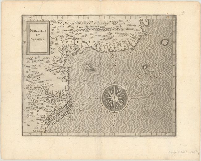
This important map is from the first atlas devoted exclusively to the New World. It shows the northeast coast of North America from Nova Scotia to the Outer Banks of the Carolinas. This was the most accurate map available at the time, depicting a period just prior to the English voyages, which would improve the cartography greatly. There is no Long Island, Hudson River or Cape Cod, and Chesapeake Bay (Chesipooc Sinus) is placed too far north. It is the second map (after the de Bry-White of 1590) to use the name Virginia in the title and incorporates much of John White's topography and nomenclature. The mythical city of Norumbega is prominently featured, and several other Indian villages are named. A large compass rose and a strange, oared ship fill the Atlantic. This is the second state of this important map.
References: Burden #103; Schwartz & Ehrenberg, plt. #40; Van der Krogt (Vol. III) #9200:371.2.
Condition: A
A dark impression on a bright sheet with the watermark of two "C" and a crown, some printer's ink residue, and a few short printer's creases at top left.