Subject: United States
Period: 1842-43 (published)
Publication:
Color: Black & White
Size:
5.5 x 8.8 inches
14 x 22.4 cm
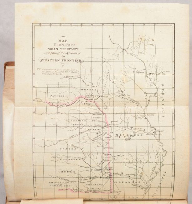
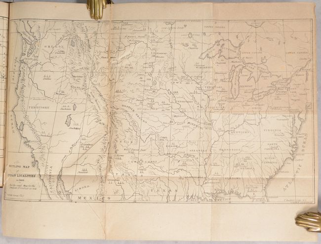
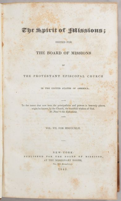
This large volume contains 24 monthly issues of The Spirit of Missions, a publication of the Board of Missions for the U.S. arm of the Protestant Episcopal Church, for the years 1842-43. Accompanying the June 1843 issue are two folding maps that "will enable its readers at a glance to understand the present positions of our Indian tribes, and also those occupied by them previous to their removal west of the Mississippi. They have been prepared with some care and expense." The maps depict the territory and Indian tribes the Board was seeking missionaries to serve.
A. Map Illustrating the Indian Territory and Plan of the Defences of the Western Frontier (6.5 x 8.8"). This small map illustrates the proximity of the Indian threat that existed and shows the location of Army posts that were expected to respond to any hostile action. The map includes the states of Missouri, Arkansas and Louisiana and the Indian nations bordering them to the west. Locates many military forts and outposts from Ft. Towson to Ft. Atkinson. Condition: Lightly toned with minor foxing. Issued folding. (B+)
B. Outline Map of Indian Localities in 1833 (14.3 x 8.4"). This map appears identical to the one issued in Catlin’s Indian Gallery, with the imprint changed to Bartlett’s Lithography. It names scores of Indian villages, designated by tepee symbols. The map extends well into Canada, locating numerous Canadian tribes. There is good detail of watersheds and the known mountain ranges. The West is mostly blank and contains erroneous information in the Great Basin region derived from Fremont's map, including an east-west flowing river. An Independent Texas is shown with its northern border extending well into the Rocky Mountains, but it is indistinct at its upper reaches. Of special interest is the depiction of the Buffalo Range that stretches throughout the entire plains region and even into Mexico. The entire Midwest north of the Arkansas River and Texas is labeled "Hostile Ground." Condition: Issued folding with toning that is more prominent at upper right. A 5" fold separation has been repaired on verso with masking tape. (B)
The text includes numerous reports with extensive detail of the challenges confronted by the Board’s three missionaries in the Republic of Texas, including threats by Mexican forces and a hurricane in 1842 that destroyed the first church in Galveston. Additional illustrations include Kenyon College and a folding map of Grebo Country, Africa. 876 total pages. Hardbound in quarter leather with tips over marbled boards.
References:
Condition:
See description for condition of maps. Text is mostly bright with some scattered foxing. A small section of text is moderately toned. Covers have light wear with a few abrasions. Binding: B+