Subject: United States
Period: 1848 (circa)
Publication:
Color: Black & White
Size:
31.5 x 10.1 inches
80 x 25.7 cm
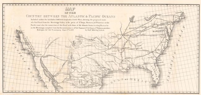
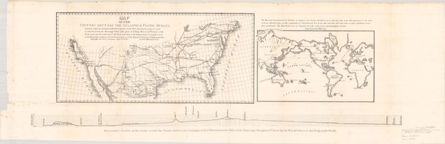
This sheet is composed of three maps and puts forth the concepts of Mills and Asa Whitney for a transcontinental railroad system. The first map by Mills shows the proposed route from Little Rock to San Diego and north to San Francisco, as well as how the proposed route would connect with the existing railroad system in the eastern United States. The second, constructed by Whitney, is a world map with the railroad continuing on to the Columbia River via San Francisco, showing the global trade opportunities the route would provide. Below the two maps is a barometric profile of the route. Size is for both maps and profile; the first map measures 16.8 x 7.8" and the world map measures 10.0 x 6.3".
References:
Condition: B+
Issued folding with light foxing, minor offsetting, and a few tiny separations at fold intersections. There is a binding trim in the left blank margin, well away from the image.