Catalog Archive
Auction 199, Lot 121

McCandlish's Humorous Prohibition Map

"Bootlegger's Map of the United States",

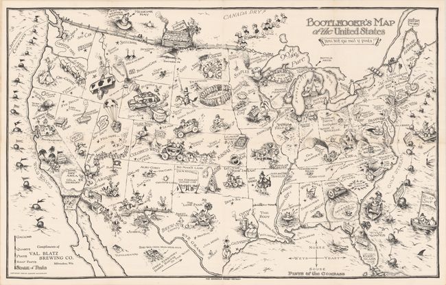
Subject: United States

Period: 1926 (dated)

Publication:

Color: Black & White

Size:
34.1 x 21.4 inches
86.6 x 54.4 cm
Download High Resolution Image
(or just click on image to launch the Zoom viewer)

This unique wall map spoofing prohibition was created by Edward McCandlish and first published in the Washington Post in 1926. McCandlish was a prominent illustrator for the children's page in many newspapers in the 1920's and 1930's, making this parody a radical departure. The Bootleggers' Map was a hit early on, and the Griswold Press (Detroit) issued a second version in the late 1920s. The map continued a successful run after Prohibition ended and was syndicated to several other publishers. Roderick Barron of Barron Maps wrote an excellent article describing the map's publication history here.

The map itself is filled with illustrations and puns, as nothing is sacred in this hilarious look at alcohol and prohibition. Many place names are plays on words, like Chi-keg-o, Albu-Corky, Fill-More, Booze (Boise), and many more (some so bad they hurt) - The pints of the compass are Norse, Wets, Yeast, and Souse. A wonderful piece of Americana that beautifully captures the humor and mood of the time.

References: Hornsby (Picturing America) pp. 59 & 72.

Condition: A

A very clean and bright example with one short split at a fold junction with minute loss.

Estimate: $1,400 - $1,700

Sold for: $850

Closed on 9/11/2024

Archived